
Technology
flying robots in combination with onboard geophysical sensors
MGT products contain modified geophysical procedures (Geomagnetics and Electromagnetics) in such a way that they can be deployed on drones. Our measurement systems have a unique design that allows high data rate geophysical measurements to be performed. Our systems use Real-time kinematic (RTK) positioning to enhance the precision of position data. It can be used either on Multicopters or Fixed Wing UAVs. The variety of flying platforms makes it possible to effectively survey wide areas up to 10,000sqkm and collect data on a very dense measuring grid at low altitudes above ground.
Advantages of drone based geophysics:
- Advancing drone geophysics
- low operational cost
- safe operation in rough terrain
- autonomous data acquisition
- unprecedented high production rate
- creation of hyper data cubes

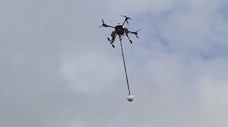
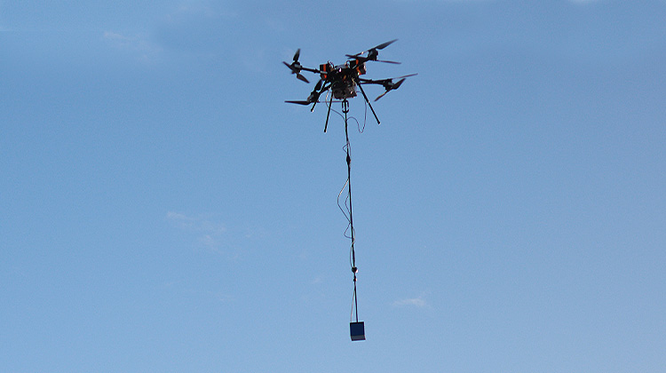
Single Mag - System
The „Single Mag UAV System“ is based on a Oktocopter platform equipped with a sensitive fluxgate magnetometer. It is ideal for geomagnetic measurements of many fields of applications, such as geophysical exploration, archeology, and geophysical near surface problems. This technology allows for cost effective wide area scanning. It‘s ideal for collecting very dense data over small grids.
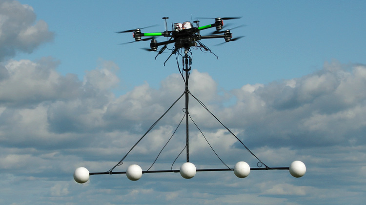
Multi Sensor Magnetometer System
Multisensors enable high detectability and tracking of shallow target than it would be possible for one sensor alone.A sophisticated terrain following navigation system ensures a stable measurement at constant clearance above ground. This sensor system enables high daily production rates to collect data over dense measuring grids.
UAV Airborne Electromagnetic System
The Airborne EM System is a low-impact, nonintrusive geophysical survey method used in mineral, geothermal, and groundwater exploration. It is an airborne frequency-domain (FD) electromagnetic sounding technique used to establish three-dimensional conductivity maps of the earth. The technique uses a fixed , grounded dipole as the energy source placed on the ground, and induction coils to measure the magnetic field on a flying platform. This method is most effective at detecting and mapping resistivity contrasts in the top 1km of the earth’s surface.
Fixed Wing System
The Fixed Wing UAV can carry up to 5 kg payload. Its long endurance of up to 3 hours makes it ideal for geophysical exploration of large areas. The rigorous design of the sensor and data acquisition system allows the integration of lightweight magnetometers and electromagnetic induction coils to perform sophisticated geophysical surveys. It is the most advanced instrument for large area geophysical exploration.
