DRONE-BORNE GEOPHYSICS
in the age of automation
Drone adoption is skyrocketing. Drones have made their way into the daily workflows across many branches in the geo-industries. With the advent of small, lightweight and power saving sensors drones of all types became an important airborne platform in geophysical surveying. As the number of fields of applications increases drone operators and clients are going to scale their drone operations, and the amount of drone data collected will only continue to grow.
MGT GmbH is a german-based, internationally operating geophysical service firm, and distributor of high-performance airborne geophysical measuring systems. Drone-enabled geophyscal airborne Systems are high-precision and cost-effective solutions for a range of applications such as mapping of geophysical properties of the subsurface (magnetization, electrical conductivity), pipeline inspection and detection and localization of small objects (UXO) in the shallow ground.
Founded in 2011 we are specialising in the design, development and sale of high-performance geophysical sensor systems. It includes sensor calibration, data processing and geophysical interpretation using hig-performance computer platforms. In collaboration with a german UAV manufacturer MGT's product portfolio includes a range of multi-rotor UAVs and fixed wing UAVs, which are combined with high-definition geophysical sensor technology. Both. drones and sensors, are tailored to provide time and cost effective airborne services even in rough and remote terrains.
MGT service portfolio
- Small object detection (UXO)
- Locating pipelines and tracking
- Mineral Exploration
- Ground Water Exploration
PRODUCTS
Our drone-based geophysical measuring systems are designed for near-surface applications and mineral exploration projects. We offer following systems:
- Standard Drone Borne Geomagnetics (Single Magnetometer)
- Multi-Sensor Magnetics
- Airborne Electromagnetics (Radio Electromagnetics)
- Semi-Airborne Electromagnetics

Airborne Geophysical Methods
AIRBORNE GEOMAGNETICS
Mineral Exploration
Geomagnetics is a standard geophysical method. The magnetic intensities are plotted on a magnetic map, the anomalies provide the basis for inferences about probable subsurface structure and composition.
AIRBORNE RADIO - ELECTROMAGNETICS
Large-Scale Tectonics | Pipeline Detection
The MGT Radio EM method is a powerful tool that enables rapid detection of lateral changes of the electrical conductivity in the ground. The method is similar to the well known VLF technique.
SEMI - AIRBORNE ELECTROMAGNETICS
MINERAL EXPLORATION | GROUNDWATER EXPLORATION
The Semi-Airborne EM method is a low-impact, nonintrusive airborne geophysical method which is ideal for applications in the mineral, geothermal, and groundwater exploration. It is a frequency-domain electromagnetic sounding technique that delivers images of the 3D electrical conductivity in the subsurface. It uses a fixed , grounded dipole as the energy source placed on the ground, and induction coils carried on a flying platform. It combines the benefits of ground EM and airborne EM surveys.
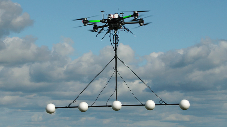
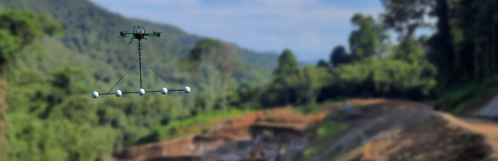
MULTI SENSOR MAG SYSTEM
UXO DETECTION | BURIED OBJECTS
Unexploded ordnances (UXO) pose a significant public safety hazard in many parts of the world. They occur on or near the surface and down to depths of several meters below the ground. One of the most established techniques for ordnance detection is magnetics. This method is very effective at locating buried metallic objects such as UXO. MGT is very successful in the use of drones which allow for cost effective wide area scanning with near 100 % coverage and near 100 % detection of subsurface ordnance or features indicative.
For more information, please download our flyer (PDF):
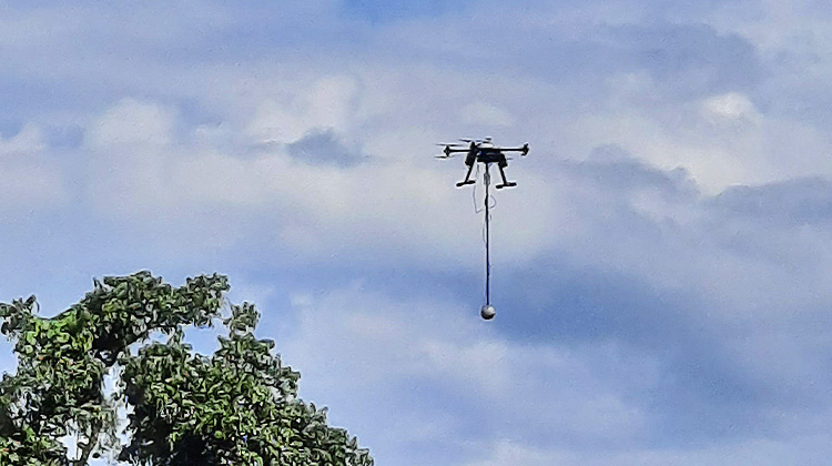
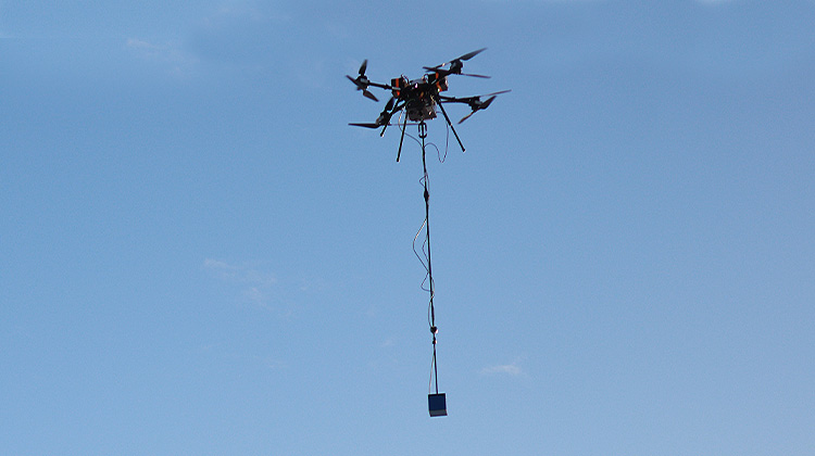
Our airborne sensor systems
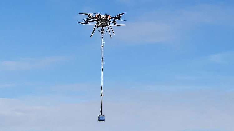
SINGLE MAG - SYSTEM
Exploration | Buried Objects
- 10 kg MTOW octocopter platform
- 1 fluxgate magnetometer
- production rate: up to 2.5 km² / day (50 line km @ 50m line spacing)
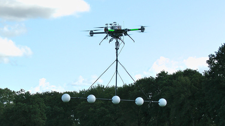
MULTI SENSOR MAG SYSTEM
UXO DETECTION | BURIED OBJECTS | PIPELINE LOCATION
- 10 kg MTOW octocopter platform
- Up to 5 fluxgate magnetometers
- production rate: up to 10 ha per day (50 line km @ 2m line spacing)
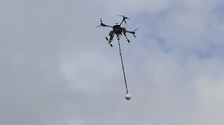
ELECTROMAGNETICS - SYSTEM
Exploration | (Hydro) Geology
- 25 kg MTOW Octocopter platform
- 1 EM system
- production rate: ~ 60 line km / day

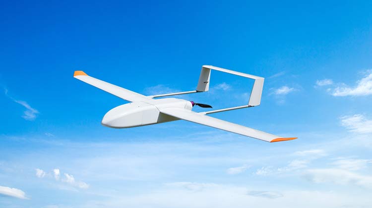
FIXED WING ELECTROMAGNETICS
- 25 kg MTOW fixed-wing platform
- payload: Electromagnetics/ Geomagnetics
- production rate: up to 500 line km per day
FIXED WING MAG - SYSTEM
Exploration | Buried Objects
- 5 kg MTOW fixed-wing platform
- payload: 1 fluxgate magnetometer
- production rate: up to 5 km² / day (100 line km @ 50m line spacing)